Concept Renders
District concept renders


A district on the Willamette River, what places like it have been worth, and what it would take here.
The City of Salem set up the Riverfront-Downtown Urban Renewal Area in 1975. In an urban renewal area, growth in property tax pays for public projects there. Property in this one was assessed at $43.3 million in 1975 and at $311.6 million in 2023. Assessed value is the value property taxes are based on. Four districts in other cities are each being built to one plan. Investment in each is between $800 million and $2.5 billion, counting money spent so far and money planned. A district on Salem’s riverfront could draw investment in the same range. Now City proposes studies of three things in Salem: a plan to bring employers and workers here together, one plan for the whole riverfront area, and the cost of building. The studies would also estimate what a district here could be worth in ten and twenty years.
A company looks for workers before it moves. An engineer looks for more than one employer before moving. Each waits for the other. A lender sees that wait as risk and charges for it. A team that recruits employers and workers at the same time shortens the wait.
One plan for the whole area sets block sizes and lines up the streets, the riverfront path and the water and sewer pipes. The whole area then shares their cost.
Building wall panels and rooms in a factory pays off when a district repeats the same few building designs many times. The studies would test whether that lowers the price of a home in Salem.
Designed so that people can build things here and build a life here, whether they grew up in Salem or are just arriving.
Now City is a development company. We want to build in Salem, and we would like other private capital to invest here alongside us.
We seek to engage a coalition of local support to test the assumptions behind the bright future we see for Salem.
Each is a challenge Salem shares with most mid-size American cities, and each is the size a district can work on.
Salem’s median home sale price was about $435,000 in March 2024, up 173 percent since 2012. A district can deliver homes in a mix of sizes at once, on land the city already serves, and hold part of that mix at prices local wages reach.
The average weekly wage here is about $1,280, against $1,569 nationally. Shared test and fabrication space, next to homes and next to training, gives making, research, care and food one address.
Oregon keeps about 64 percent of its graduates for five years, then loses residents aged thirty to fifty. What decides whether someone stays is usually a home they can afford near work worth having.
About 16 percent of people in Salem live with a disability, and the 2023 count found 1,683 people without housing. A neighborhood can be laid out around caregiving, childhood and older age, and restore the riverbank while it is built.
Most of the 16,605 homes built here since 2000 were single detached, one at a time. Streets and pipes planned once for a whole area share their cost across it.
Salem aims to halve emissions against a 2016 baseline by 2035 and adopts its Climate Friendly Areas by mid-2026. A district can keep working through a heat wave or an outage, with most daily trips short enough to walk.
These conditions are in place today and are mostly under-used.
The Willamette runs between downtown and West Salem, with public land, an island park and two bridges. Most of the frontage is currently industrial or fenced.
State government, a regional hospital system, universities within reach, and community colleges running programs in robotics, machining and industrial electronics. Employment here is steadier through downturns than in comparable cities.
Salem is within an hour of Portland, the Hillsboro semiconductor cluster, Oregon State and Eugene. It is the only point on that line within reach of all four, and the seat of state government.
Food processing, wood products, logistics, advanced manufacturing and a humanoid robotics factory. The jobs span several wage levels.
Developable land inside the urban growth boundary, industrial buildings suitable for adaptation, and prices that still allow ownership on local wages.
Our Salem calls for mixed-use riverfront development and housing near major employment centers. The City’s 2026-2031 Strategic Plan puts the City in the role of Partner on lowering the cost of multi-family housing. Its Climate Action Plan strategy list, which is advisory, recommends housing near employment and walkable mixed-use close to downtown.
The Brookings Metro Monitor for March 2026 places Salem fourth for prosperity and seventh for growth among 85 US metro areas of between 250,000 and 500,000 people, and in the top fifth of all metro areas for inclusion. The figures reach us through a stakeholder submission to the Oregon Prosperity Council rather than through the Council’s own findings.

Four facts describe the riverfront and nearby neighborhoods today. Each takes many projects over many years to change, which is why the proposal covers a whole district.
Most of the city is built at a scale that requires a car for every trip, which limits street life and raises household transport costs.
There is no continuous public edge along the water, and few places to eat, work, live or launch a boat.
Salem adopted its first Housing Production Strategy in 2025 with seventeen actions. The open question is delivery capacity.
West Salem is largely residential and downtown empties in the evening, so the bridges carry commuters in the morning and again at five.

Salem has a river through the middle of it, and very little built to face the water. The area under study runs along both sides of it, because a continuous public edge, a crossing built for people and shared infrastructure only make sense at that scale. An old railroad bridge already links the two sides and carries people on foot and on bikes.
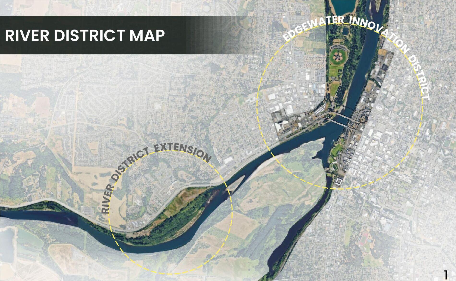
The downtown waterfront on one side and the industrial blocks on the other, treated as one place rather than two. The west bank has buildings worth adapting for workspace and homes above. The east bank has open waterfront that would take new construction. A market and a continuous public edge along the water.
A large area of riverfront land, most of it undeveloped, which gives the work room to continue once the first phases are complete.
A district also has time to fill, and the standing buildings on the west bank are what fill it. Space that is vacant or under-used can carry markets, food, events and maker space long before any new construction finishes, so a market, a food operator and a workshop tenant can be in the ground while the rest is still being studied.
A working framework at this stage. Each component is a hypothesis about what the district needs, and each is open to revision.


Mixed-use innovation and residential blocks on either side of the water, so the district has a daytime and an evening population.
A central park and a continuous public trail and habitat edge along the water.
Sports fields, a market, a civic lawn and event space.
Light industrial space and workshops with homes above, in buildings that already stand.
Retail, dining and civic frontage on the east bank, sited to strengthen downtown.
Transit and shared parking in one location, and a river crossing built for people on foot and on bikes.
These are studies of West Salem's existing industrial buildings adapted, and of the daily life the district is designed to support.
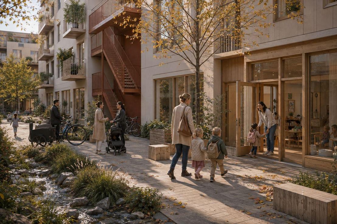
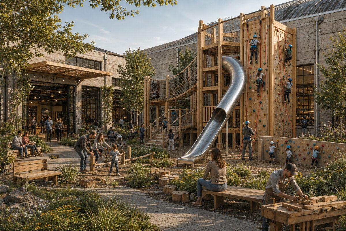
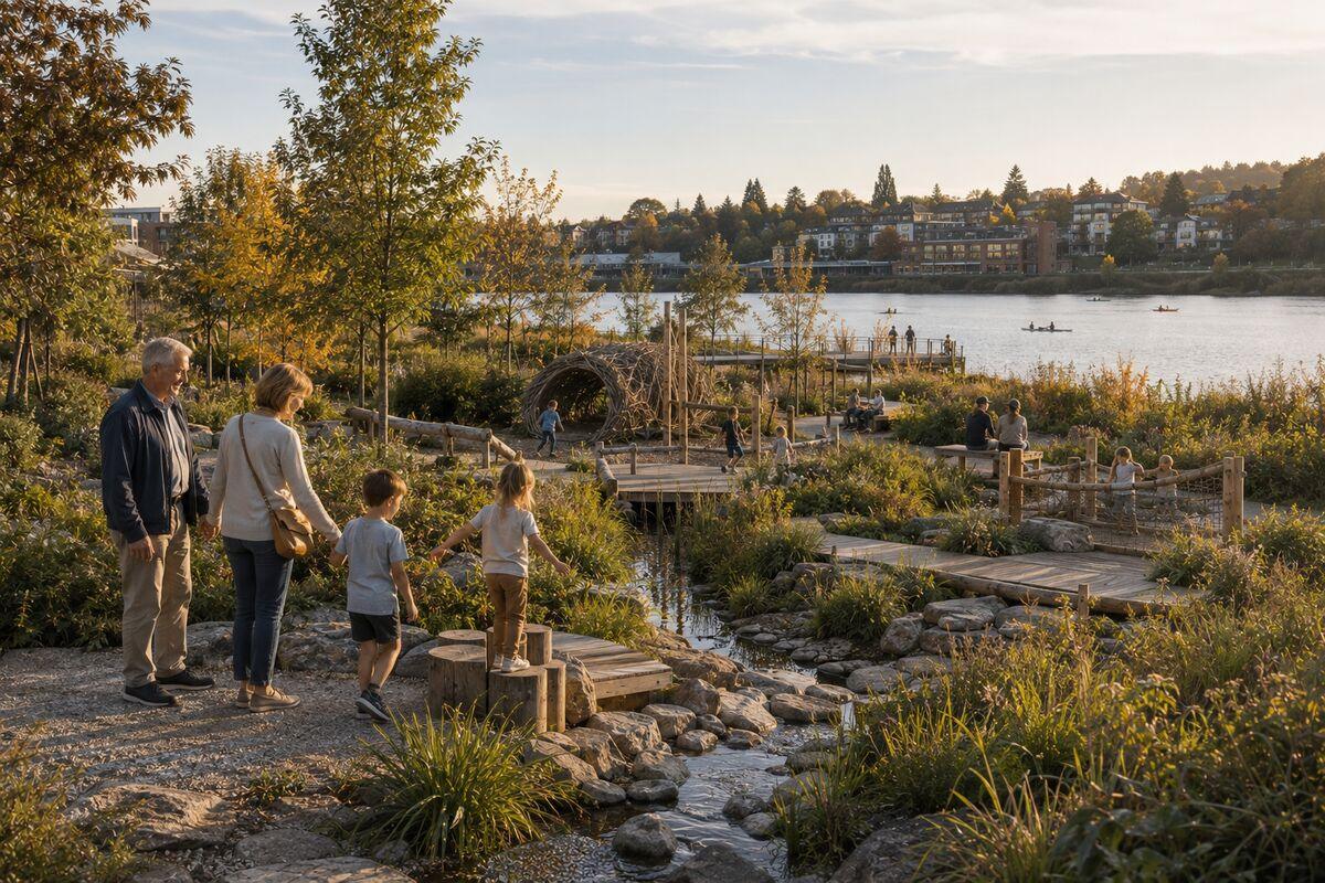
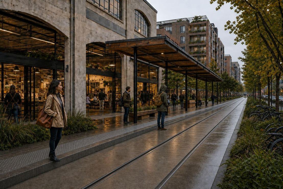
The employment here could span several wage levels. Fabrication, food production, maker space and light industry, research and engineering. That range matters, because a district has to house the people who work in it.
Large-format industrial development belongs at Mill Creek Corporate Center on the east side of the city, which is already built and marketed for it. This district holds the smaller-format work that fits beside housing: workshops, assembly, studios and labs in buildings that already stand.
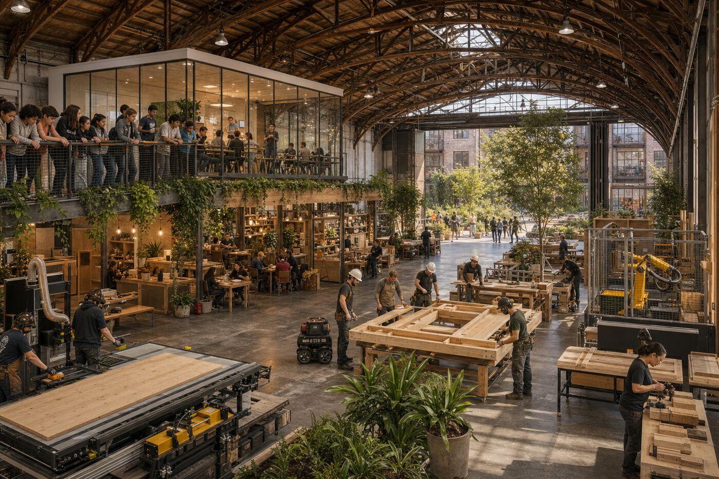
Oregon has a mass-timber sector, a federal Tech Hub for it, and an established wood products industry in the valley. The regional housing shortage is the demand.
Community college and university programs in robotics, machining and industrial electronics already operate here. What is required is local work and housing within reach of it.
Employment growth on the east side of the city creates demand for housing. This district is within reach of it, and the market study would establish how much of that demand it could serve.
The blocks are drawn around a shared garden, with shops and daily life at the street edge. Homes face the street on one side and the garden on the other, which gives most of them daylight from two directions. The mix runs from studios to three-bedroom townhomes, for renting or for owning.
Each block wraps a shared garden that children can use, overlooked by the homes around it, so several families can see the same space from their kitchens.
Ground floors hold shops, cafes and workspace, so daily errands can be done on foot and the street stays in use through the day.
Studios through three-bedroom townhomes in the same block, built to a standard that keeps energy bills low, so households at different stages can stay in one neighborhood.
The homes use wood and other natural materials, with insulation, windows and ventilation built to a standard that holds temperature and keeps running costs down.
The ground floors hold the things a household needs most days: childcare, a clinic, food, and space small businesses can afford. Putting them in the block means those trips are made on foot rather than by car.


Two of the ideas on this page are less settled than the rest. Both would need their own study, and the district would work without either. They are here because they are worth arguing about now rather than later.
A timber tower with a continuous ramp to the top, so it can be climbed by anyone, including people using a wheelchair or a stroller. The climb would be used to tell the story of the place: the people who lived here first, the valley’s farming and biodiversity, and the river itself. From the top you would see the Willamette running north and south.
Photograph: Camp Adventure Forest Tower, Denmark, by EFFEKT with ARUP, opened 2019. Shown as the precedent described above rather than as a design for Salem.
Swyft Cities' Whoosh is a cable-based network of five-passenger, battery-electric autonomous vehicles - 30 mph, with offline stations so every trip is nonstop and a vehicle is always waiting. It runs above Highway 22, the Willamette, Pringle Creek and the rail line, which are the things that make crossing this part of Salem slow. A concept sketch for Salem maps 16 stations across 4.5 route miles linking West Salem, downtown, Riverfront Park, and Willamette University.
Render by Swyft Cities. Source: "The Potential for a Whoosh Transit Circulator in Salem, OR" (Now City & partners, 2026) and the City of Irvine Great Park travel demand analysis cited therein.
The district is being designed for the families, workers and businesses who live in the Willamette Valley now. The measurements on this page and in the study plan are how that gets checked rather than asserted.
Salem sits in the middle of the Willamette Valley, which is one of the most productive farming regions in the country. The coast and the Cascades are both about an hour away by road, and the state capital and its institutions are here.
45 minutes to Portland - international airport, talent, culture - and 60 minutes to the Oregon Coast.
People arrive here from the more expensive West Coast metros. Oregon ranked first in the nation for inbound share of moves in 2025, and Salem seventh among US metros, on one moving company’s own shipment data (United Van Lines). That counts arrivals rather than net migration, and Oregon is still losing residents aged thirty to fifty, which is the third challenge set out earlier on this page.
Housing costs less here than in the metros people arrive from. Closing that gap fairly, for the households already living in Salem, is what the outcomes on this page are meant to test.
Places where a district on this ground would meet work the City has already adopted or has under way this year.
Six places where a district on this ground would meet goals the State has already set.
These are the things Now City would design for here. Each one can be checked by a study or a measurement, and several line up with the outcome measures the City proposes in its 2026-2031 Strategic Plan.
Stormwater cleaned on the block before it reaches the river. The bank replanted. Tree canopy and habitat added rather than removed. The City’s 2026-2031 Strategic Plan proposes to measure water quality, riparian acres restored and tree canopy coverage, so these could be reported the same way.
Buildings, energy, water and food supply designed to keep working through a heat wave, a flood or a power outage, so households are safer and the wider city has somewhere that still functions.
Designed around caregiving, small children, older residents and people who do not drive. The measures are daylight, walking distance, step-free access, and somewhere to sit along the way.
The parts of a neighborhood people use every day, put close enough together that a day takes fewer car trips.
Salem’s Climate Action Plan strategy list recommends a network of neighborhood resilience hubs: indoor places that work as community centers most of the time, and as cooling centers, food distribution points, places to charge during an outage and evacuation sites when they are needed. A district can hold one without building anything for that purpose alone.
The Willamette Valley is one of the most diverse farming regions in the country, and Salem sits in the middle of it. A district here could connect that farming to processing, markets and daily meals in one place.
Oregon already has companies and researchers building tools that act on the physical world. A district gives them somewhere real to apply that work, on problems people can see. These are the five we would start with.
Planting here would be built to perform, in the same way a street or a pipe performs. It cools the air, holds and cleans water, and supports habitat, at the same time as being somewhere pleasant to sit.
Places designed around the daily realities of women, children and older adults tend to do better on health, safety and how long people stay. Designing for the people with the least margin produces a place that works for everyone.
Drawing a district costs little. Finding out whether the market, the ground, the public tools, housing delivery and travel support it is a separate body of work, and it has its own page.
The nine studies, the order they would run in, who is best placed to run each one, and what we are asking for. Read the plan.
The working side of the same ground: what would be made here, who would make it, and why several industries in one place is the part worth testing. Read that page.


